Showing posts with label environmental destruction. Show all posts

Thursday, July 8, 2010

bald mountain try

i must have heard the weather wrong because i thought today was supposed to not be as hot as the others have been. anyway i tried to hike bald mountain in the ossipee mountains.


i started on gilman valley road where there are lots of signs


i walked through the hidden gravel pit. the dirt piles had changed and the bucket loader had moved since i last was here (http://ossipeemtnhiker.blogspot.com/2010/06/walk-in-stony-brook-valley.html)
the logging company agreed to close the gravel pit when they were given government money to preserve the land. it was supposed to be closed and rehabilatated a few years ago but theyre still using it.
it was hard to climb up the steep embankments of the pit as i tried to get up to the logging road to bald mountain.

i then saw a machine parked on a snowmobile trail. they were doing something in the woods next to a snowmobile bridge.

i went up the logging road to bald mountain. when i got around the corner a little while, the logging road got pretty rocky.

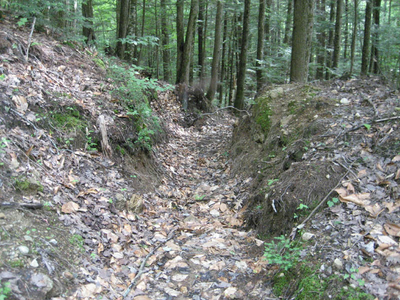
it was really eroded. i didn't see any water bars and it got worse as i went higher up.

finally it got really eroded and i was getting worried i'd get hurt so i turned around.
the walking was really rough. i'm surprised the government let them do this to the protected land. i want to visit bald mountain but i think this road may be too rough for me.

Wednesday, June 23, 2010

grant peak (almost)

today i tried to hike grant peak in the ossipees. grant peak is the highest part of nickerson mountain.

i started at gilman valley road. there were some nice flowers:

i started up a logging road i saw on google earth:

it was wicked steep for long straight stretches:


there werent too many water bars but there was a big one at the bottom:

it looks like the logging road is washing down into the stony brook:


there were lots of logging remains:


there were also some deep ruts. it must have been a big skidder:


it was also a little bit muddy in places even though its been dry lately:


more logging remains:


more mucky stuff:


there was a view though i think of mount whitter:


the straight steep sections of the logging road, as well as trying to step over lots of branches and stuff made this a tougher hike than i thought. i was surprised how little stuff was growing up in the logging road even though the wood looks like it was cut awhile ago. im surprised the government is allowing this on the forest legacy area.

Saturday, June 19, 2010

a walk in the stony brook valley

the other day i went for a walk in the stony brook valley. it is located between mount whittier and grant peak.

there were some neat ferns at the entrance:

awhile later i saw a nice field on my left. i decided to walk up it to get a view:

i saw a gravel pit behind it:

there was fresh dirt. they must have been using the bucket loader recently:


it was a pretty big gravel pit.

it started to rain a little bit so i turned around. i didn't know there was a gravel pit out here i thought it was just woods. it was nice to get out for a walk though.

update i read that in the "Grant of Conservation Easement" document filed with the carroll county registry on march 28 2002, chocorua forestlands had an "obligation to restore and reclaim the Gravel Reserve" after "two (2) years commencing on the date this Conservation Deed is signed". interesting. i think that would mean that in 2004 the gravel pit would have been closed. it looked active to me when i was there this year (2010).